

The age of the undisputed rule of fossil fuel and automated transportation (cars, trains etc), at least as we had known it until now, is coming to an end. The discovery of new uses for the traces (and scars) trains and cars left behind during the past centuries is becoming a more important priority. Quality of life, instead of productivity, is now making it to the top of the agenda. OK, sometimes at least, which is still better than ‘almost never’ – which used to be the case.
At the same time, new cycling and walking paths are being drawn to accommodate citizens with itchy feet on exactly the same lines where, just a few years ago, roads would have probably been paved in their place.
What might the infrastructure of a more mildly and sustainably developed, greener and healthier world look like? Some spots around our network can already offer us a glimpse of this prospective reality.
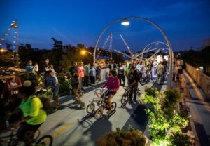
Enjoy Western Chicago by using this 4.3km of converted elevated railway

The Bloomington Trail or Line, also known as The 606, used to be an elevated train line that would serve the northwest suburbs of Chicago; now it’s a converted elevated greenway that stretches for 2.7 miles (4.3km) serving runners, cyclists, and pedestrians and is, of course, one of Spotter Meghan’s favorite places in Chicago.
“The trail itself is a peaceful oasis away from the hustle and bustle of the city with art installations and greenery backed by the city’s urban landscape. With 12 exit ramps and several parks along the trail, it’s a destination for locals to use as a neighborhood shortcut or just to enjoy!”
You can view a map of The 606 on the official website.
Chase the echoes of the old steam trains in Edinburgh
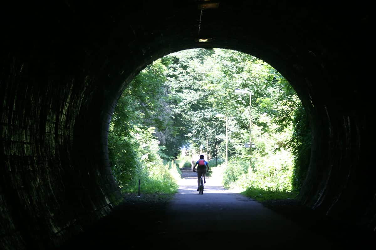
Edinburgh seems to consist of parallel worlds quite literally stacked on top of each other, just waiting to be explored. One such world-layer is its network of abandoned old railway lines that are like “ribbons of nature crisscrossing the city”.
“Often they are hidden from view”, writes Spotter Anson, “the only clue being an old railway bridge – you often need to ask a local where they are, although the major routes are now signposted.”
“My favorite is the route from Scotland Street in the New Town to Newhaven and the Firth of Forth. There are a number of tunnels along the route as well as a former station, so you will be constantly reminded of the route’s original use as the key transport route to the coast. You will not see any cars on your journey towards the sea, just plenty of cyclists, walkers, and the resident wildlife.
“A map has been produced by the Bike Station based on the design of the London Tube map. The Inner Tube shows the key routes which are cycle friendly and the stops along the way.”
Walk, cycle and jog on a 33km symbol of comradeship and connection in Ljubljana
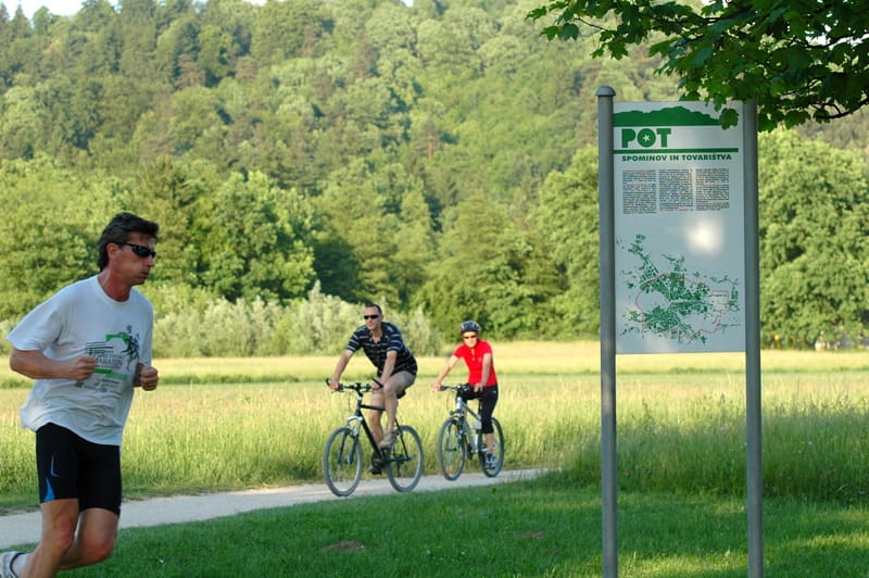
Pot means ‘path’ in Slovenian, and this is the Path of Remembrance and Comradeship. “How come the epic name?”, you may be asking. This trail comes with historical emotional baggage, a fact which only makes it even more inspiring. Spotter Tjaša puts it quite poetically:
“Where there used to be a barb wire fence which surrounded Ljubljana during World War II, there is now a 33km long path which crosses today’s urban area and outskirts of the city. What was built to prevent contacts between the city and its hinterland is now connecting Ljubljana”.
It’s an ideal route for the usual jogging, walking, cycling and enjoying nature every day of the year, apart from May 9th, when it becomes extra-important, as it holds the annual traditional recreational March to celebrate the liberation of the city on May 9th 1945.
You can see a map of this path here.
Go from peak to peak on this scenic Lisbon corridor
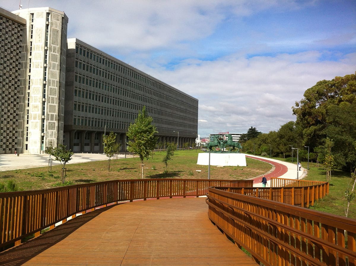
This wooden bridge at the Monsanto Green Lane gives us vivid images of what a cycling ‘highway’ connecting distant and discrete hilltops would look like. Actually, that’s not far from the truth at all. We’ll just let Cláudio do the talking here:
“Lisbon is well known for its hills, which provide wonderful views all around, but, on the other hand, makes it a city where it’s incredibly difficult to do walking or cycling exercises. So recently the city administration decided to connect those hills, and now it’s never been so easy to do jogging, walking, running or cycling round Lisbon, altogether with an astonishing view.”
“It starts in Eduardo VII park, at the very top. This is the first great view over the castle and the river. There you’ll find a wooden bridge, brand new, and that’s the start. I usually walk that way, passing by interesting places like the Palace of Justice, the Mosque, and the nice Nova University buildings. Just in front of it, there is a hill I always climb up for its gorgeous view of the aqueduct. Along the path, there’s a sensation that you’re always overlooking the city. By the end of the path you enter the huge green forest of Monsanto.”
Walk along the aqueduct in Lisbon
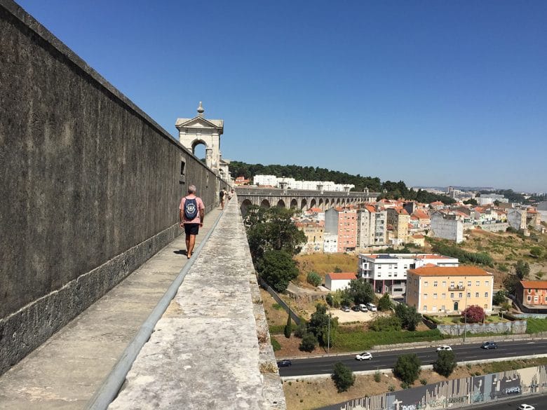
Also in Lisbon and a bit different than the previous spots is the Aguas Livres Aqueduct. It used to bring the water from Sintra to Lisbon and survived a big earthquake in 1755.
“It is the biggest, if not the widest Lisbon monument in sight. And probably, the oldest. And having the privilege to walk on this historical site is an amazing experience. It’s a huge architectural piece of history, which is the exact same way it was almost 300 years before.”
Although it’s not that green at all, it’s still a great way to make use of the already existing infrastructure. You get to enjoy great views from up there and it’s a perfect way to spend a beautiful afternoon in the sun whilst breathing in some architectural history.